
Guildford to Peasmarsh
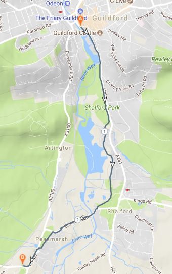
The proposed route follows the existing Shalford Park/Dagley Lane shared use route to just beyond Shalford where it crosses the River Wey at Broadford Bridge. It uses the existing shared path along the Old Portsmouth Road at Peasmarsh to the entrance to Guildford Crematorium.
This option is best suited for family friendly use. It is already largely established as a cycle route – much of it is National Cycle Route 22. While improvements are needed, these present considerably less of a challenge than the modifications that would be required alongside the A3100 to make this a cycle-friendly for families. The River Wey Navigation towpath is already a permissive route for cyclists but is managed by the National Trust for purposes not wholly consistent with those of the proposed Greenway.
The proposed route is 2.7 miles in total and the cost of the changes required are estimated to be between £100,000-350,000. Around a third of that is required for a crossing of the Old Portsmouth Road at Peasmarsh.

This route will easily link to Shalford and on wards, via the Downs Link, to Bramley, Cranleigh and potentially Dunsfold Park.